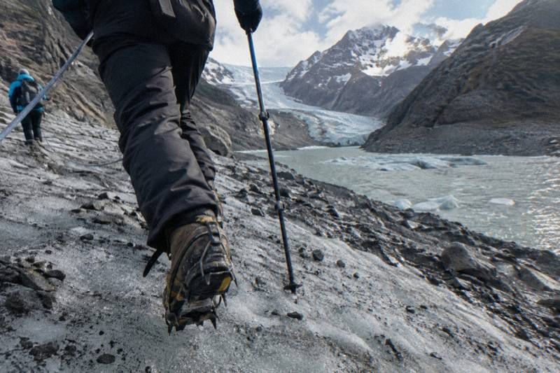
Tasman Glacier Facts To Know Before A Heli Hike
The Tasman Glacier is the largest and longest glacier in New Zealand, 23 kilometres of ice squeezed between peaks over 3,000 metres, and most heli hikers arrive knowing almost none of its story. Here are the facts worth having before you book.
Short answer
The Tasman Glacier is 23 km long, up to three km wide and 101 square km, making it New Zealand's largest and longest glacier. Its lower reaches are covered in rock, Tasman Lake did not exist until 1974, and the glacier is retreating as the climate changes. Three brands sell a similar 3-hour heli hike onto it from Mount Cook Airport.
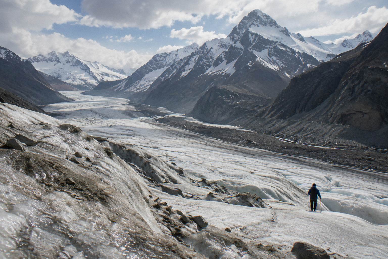
The Tasman Glacier does not look like the postcard version of a glacier for most of its length. From the highway at the park entrance you see a broad grey tongue of rock-strewn ice, 23 kilometres of it, the largest and longest glacier in New Zealand, with the clean white neve hidden far up at altitude. That gap between what you see from the road and what you stand on during a heli hike is exactly why the facts below are worth ten minutes of your time. The ice a hiker walks on sits around 1,200 metres above sea level according to Alpine Guides, a different world from the rock-covered snout visible from the valley floor.
Everything here draws on Department of Conservation pages and the operators' own material. Where a number belongs to one company and not another, it says so, because the three brands selling this heli hike do not agree on ages, durations or weight rules. For the full picture of the flight-and-hike day itself, read the companion piece on the heli hike from landing to lift-off.
How Big Is The Tasman Glacier?
The Tasman Glacier is 23 kilometres long, up to three kilometres wide and covers 101 square kilometres, which makes it the largest and longest glacier in New Zealand. It is one of five major glacier valley systems in Aoraki / Mount Cook National Park, alongside the Godley, Murchison, Hooker and Mueller, and it is visible from the main highway at the park entrance without leaving your car.
Those figures come from the Department of Conservation, and they are worth sitting with for a moment. A glacier three kilometres wide is wider than most New Zealand towns are long, and 101 square kilometres of ice is roughly the footprint of a small city. The park itself holds 19 peaks over 3,000 metres, with Aoraki / Mount Cook the tallest at 3,724 metres, and glaciers cover 40 percent of the entire park. The whole area sits inside the Te Waipounamu South West New Zealand World Heritage Area, one of the reasons the landscape is protected at this scale in the first place.
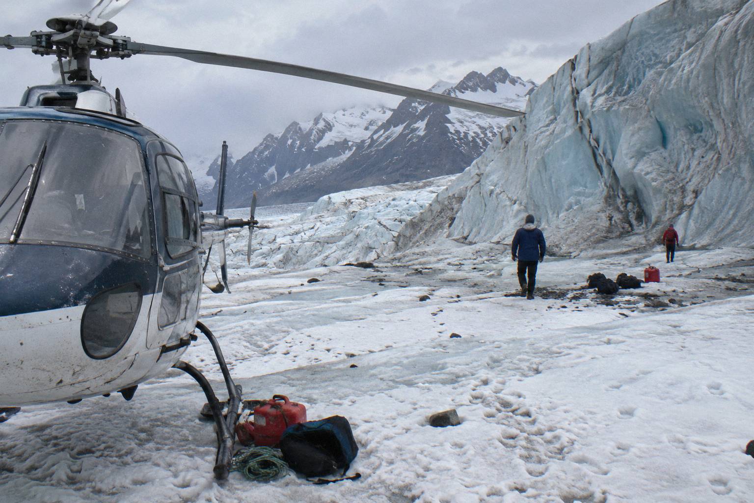
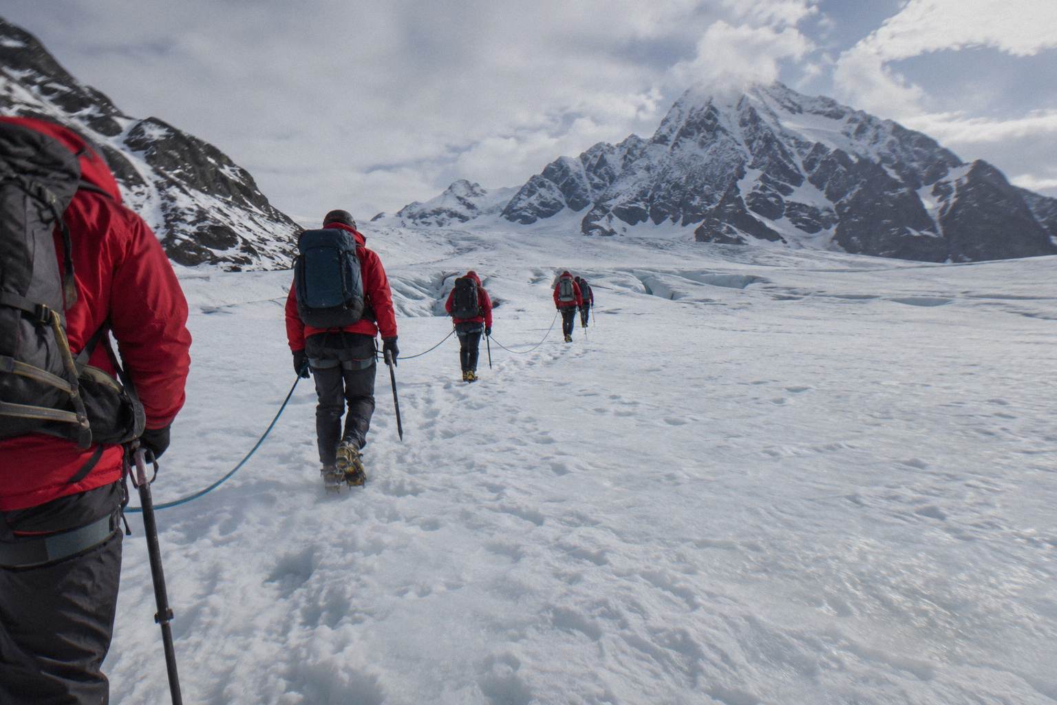
The heli hike lands you in the middle stretch of this system, well above the rock-covered lower reaches. Alpine Guides describes landing around 1,200 metres above sea level on the glacier itself, with the return flight passing close to the Hochstetter Icefall, which the same operator measures at roughly 1,000 metres high. Picture two glaciers in one: a grey, melting, rock-mantled tongue below, and a vast white catchment of snow and ice above, with your hike happening in the cleaner upper half.
| Fact | Figure | Source |
|---|---|---|
| Length | 23 km | DOC |
| Width | Up to 3 km | DOC |
| Area | 101 square km | DOC |
| Ranking | Largest and longest glacier in New Zealand | DOC |
| Landing altitude on the standard heli hike | Around 1,200 m above sea level | Alpine Guides operator page |
| Neighbouring icefall | Hochstetter Icefall, roughly 1,000 m high | Alpine Guides operator page |
Where Is The Glacier And How Do You Get Onto It?
The Tasman Glacier drains the eastern side of Aoraki / Mount Cook National Park in the South Island of New Zealand, and the heli hikes that land on it all depart from Mount Cook Airport on State Highway 80, a short drive before the village. Driving times published by DOC are 3.5 hours from Queenstown and 4.5 hours from Christchurch, with Twizel an hour away and Tekapo 1.5 hours.
The airport sits on SH80 before the village, so most heli hikers stay the night before somewhere in the Mackenzie region or the village itself. The logistics of check-in times and where to sleep are covered in the guides on where the heli hike departs and checks in and where to stay for an early heli hike, but the geography is simple: one road in, one airport, one glacier overhead.
What varies is who flies you. The two bookable heli hike options are the Glacier Guiding 3-Hour Heli Hike, rated 4.9 from 340+ reviews, from NZ$1,021 per person, and the Helicopter Line 3-Hour Heli Hike, rated 4.8 from 270+ reviews, from the same NZ$1,021 starting price. All prices here are in New Zealand dollars. Both run about 3 hours door to door with up to 2 hours on the ice, and both include boots, crampons and outerwear in the ticket price.
- Glacier Guiding 3-Hour Heli HikeNZ$1,021
- Helicopter Line 3-Hour Heli HikeNZ$1,021
- 12-Hour Bus Combo, Heli HikeNZ$1,210
- 7-Hour Fly-In Heli HikeNZ$2,149
If reading about the glacier has already sold you on standing on it, these are the three strongest ways to do it or to see it from the air:
Three Brands, One Glacier Hike
The same Tasman Glacier heli hike is sold under three brands: Mt Cook Glacier Guiding flying with Mount Cook Ski Planes and Helicopters, The Helicopter Line flying with Alpine Guides as guides, and Southern Alps Guiding, which describes itself as an approved DOC concession holder. They are different companies offering a very similar day out, and their minimum ages, durations and cancellation terms genuinely differ, so always check the brand you actually booked.
Mt Cook Glacier Guiding's product is named The Adventurer on the Mount Cook Ski Planes operator page: about 3 hours in total, up to 2 hours on the glacier weather permitting, a minimum of 4 people to depart, age 9 and over with under-18s needing parental or guardian consent, and crampons or snowshoes depending on season. Mt Cook Glacier Guiding has no website of its own, so never go looking for a separate address. The Helicopter Line version, detailed on the operator's Tasman heli hike page, is about 3 hours per The Helicopter Line and 3.5 hours per Alpine Guides, with a guide ratio of 1:12, a minimum of 4 per helicopter load, minimum age 10, and a 150 kg maximum for a rear helicopter seat that applies to that operator only.
Southern Alps Guiding is the third brand, shown on its own operator page with a 9:00 AM start and "Low to Moderate" fitness wording, but it is context here rather than a bookable option. None of these brands should be framed as rivals or ranked against each other, and none of them invented the route: they share the same landing zones on the same ice, licensed under the same national framework. The practical takeaway is that figures like minimum age and weight belong to a brand, never to "the heli hike" as a whole.
Glacier Guiding's departure has the deepest review trail, 4.9 from 340+ reviews, and you can read the full details on the Glacier Guiding heli hike guide page or check the tour page for dates, Check availability before you lock in accommodation, since departure windows shape the whole day.
The Helicopter Line departure is the natural comparison, 4.8 from 270+ reviews at the same from-price, with check-in 15 minutes before departure upstairs at Mount Cook Airport. If your group includes a nine-year-old, the age split matters more than any other difference: 9 with Mt Cook Glacier Guiding, 10 with The Helicopter Line.
| Brand | Aircraft partner or guide | Min age | Total time stated | Min group |
|---|---|---|---|---|
| Mt Cook Glacier Guiding | Mount Cook Ski Planes and Helicopters | 9 | About 3 hours | 4 to depart |
| The Helicopter Line | Alpine Guides | 10 | About 3 hours (3.5 per Alpine Guides) | 4 per helicopter load |
| Southern Alps Guiding | States helicopter or ski plane | Not printed here | 9:00 AM start stated | Not printed here |
Why Is The Lower Glacier Covered In Rock?
The lower reaches of the Tasman Glacier are blanketed in rock because the glacier picks up debris from the surrounding mountains as it flows, and as the ice thins and slows, that debris concentrates into a continuous grey mantle that insulates the ice beneath. DOC notes the rock-covered lower reaches as a defining feature, which is why the glacier looks like a grey river from the highway even though clean ice sits above.
This is the single biggest gap between expectation and reality for first-time visitors. People picture Fox or Franz Josef style blue ice walls visible from a valley floor, and the Tasman instead shows a broad, dusty, boulder-strewn surface that reads as a plain grey riverbed if nobody tells you otherwise. The rock is not pollution and not a sign the glacier is dead; it is moraine, swept off the valley walls by decades of movement, and it is precisely why the heli hike exists at all. Walking up the valley to the ice would take most of a day over unstable ground, so a short scenic flight to the cleaner ice above is the only practical way to put a guided group on the glacier.
The rock mantle also explains the colour of Tasman Lake water, milky grey from rock flour, fine ground rock suspended in the meltwater. Every landmark in this valley, the grey tongue, the lake, the icebergs, traces back to the same process of a large glacier slowly losing volume. The retreat question gets its own section below, because DOC's wording on it is careful and worth repeating exactly.
Why Did Tasman Lake Appear Only In 1974?
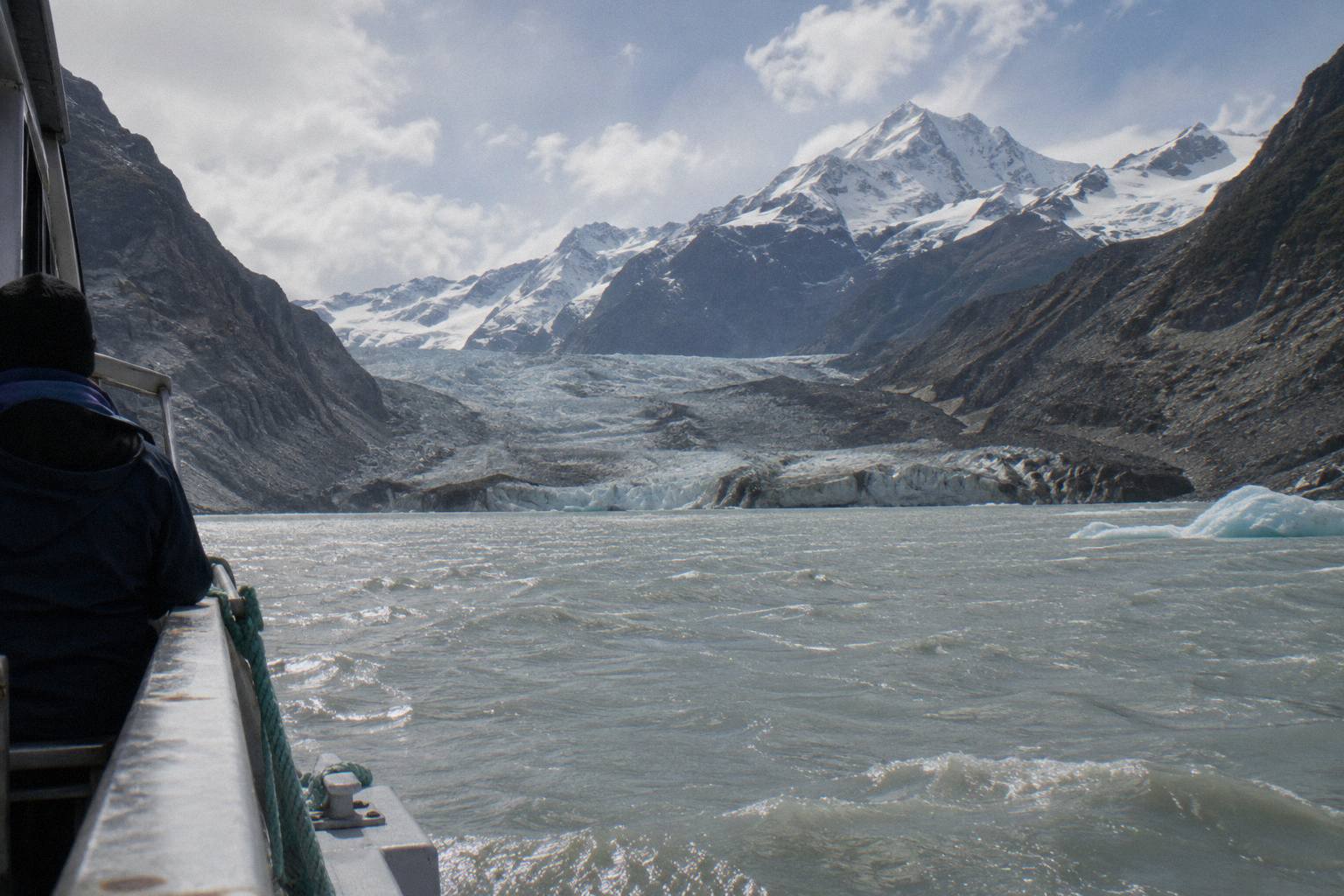
Tasman Lake did not exist until 1974, DOC states, and it is growing rapidly as the Tasman Glacier melts, which means every photograph of iceberg-dotted water in this valley shows a landscape younger than most of the people hiking beside it. The glacier's retreat created the lake, and the lake in turn accelerates melting at the terminus, a feedback loop the department describes plainly: "Like glaciers worldwide, Tasman Glacier is retreating as the climate changes."
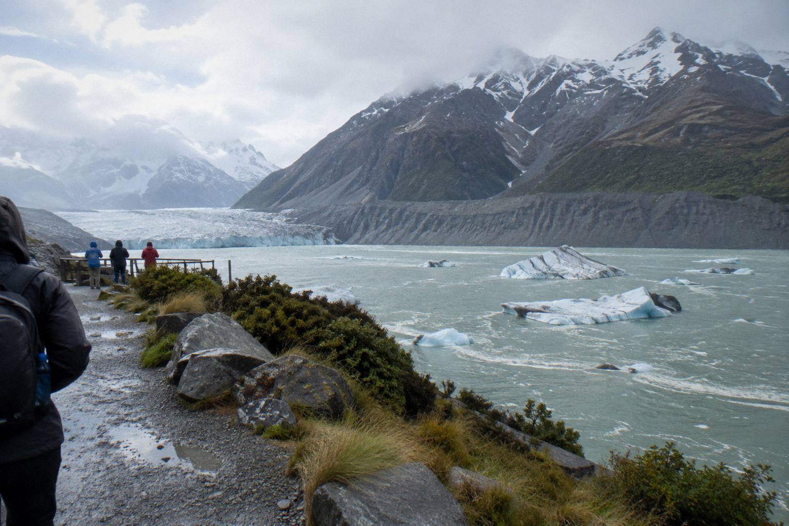
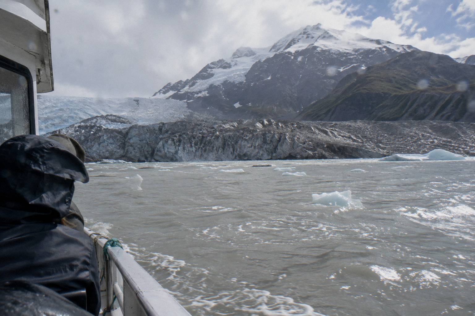
That quote comes from DOC's Tasman Glacier View Track page, and the 1974 date is the most striking single fact in the valley. Meltwater ponding at the snout of the glacier consolidated into a permanent lake only half a century ago, and it has been expanding ever since as the ice edge pulls back and calves icebergs into the water. Summer visitors see icebergs drifting on the lake; winter brings lake ice instead. DOC warns specifically about hazards from the glacier lake and moraine wall, unstable icebergs and very cold water, which is why the lake is for viewing from the track or a boat, never for swimming or walking onto floes. More of these guides are collected on Mount Cook Helicopter Hike.
The lake is best seen from the water on a licensed boat trip, which is a separate product with its own planning site at tasmanglacierboattour.com if getting close to the icebergs appeals. From the heli hiker's point of view the lake matters most on the flight out: the pilot's route up the valley gives you a direct view of the terminus and the rock-covered tongue that you would otherwise never see from the ice itself.
Is The Tasman Glacier Retreating?
Yes, the Tasman Glacier is retreating, DOC says so directly, and a 2026 end-of-summer snowline survey by Earth Sciences NZ, formerly NIWA, saw retained snow on some glaciers but called it "only a stay of execution and not a reversal in the long-term decline of ice coverage". The glacier is not in imminent danger of vanishing on any human timescale a traveller needs to plan around, but the long-term trend is one-directional.
That snowline survey wording deserves to be read in full, because it cuts through both the doom and the complacency. The survey found genuine retained snow on some glaciers after the summer, real accumulation, and still framed it as a stay of execution rather than a recovery. For a heli hiker the practical meaning is straightforward: the glacier you walk on next year will be slightly different from the one walked on this year, the landing sites shift with conditions, and operators explicitly say the primary Tasman landing site may vary. None of this affects safety or bookability; it just means the landscape is a moving target, which is part of why a guided, geared hike beats an independent attempt.
Figures for ice thickness, annual retreat in metres, or the size and depth of Tasman Lake are not published. DOC publishes none of those for the Tasman, and numbers circulating elsewhere are secondary at best. If a blog quotes a retreat rate in metres per year without a source, treat it with suspicion. The sourced picture is the one above: 23 kilometres of ice, a lake younger than 1974, and a documented long-term decline.
What Is The Tasman Glacier View Track?
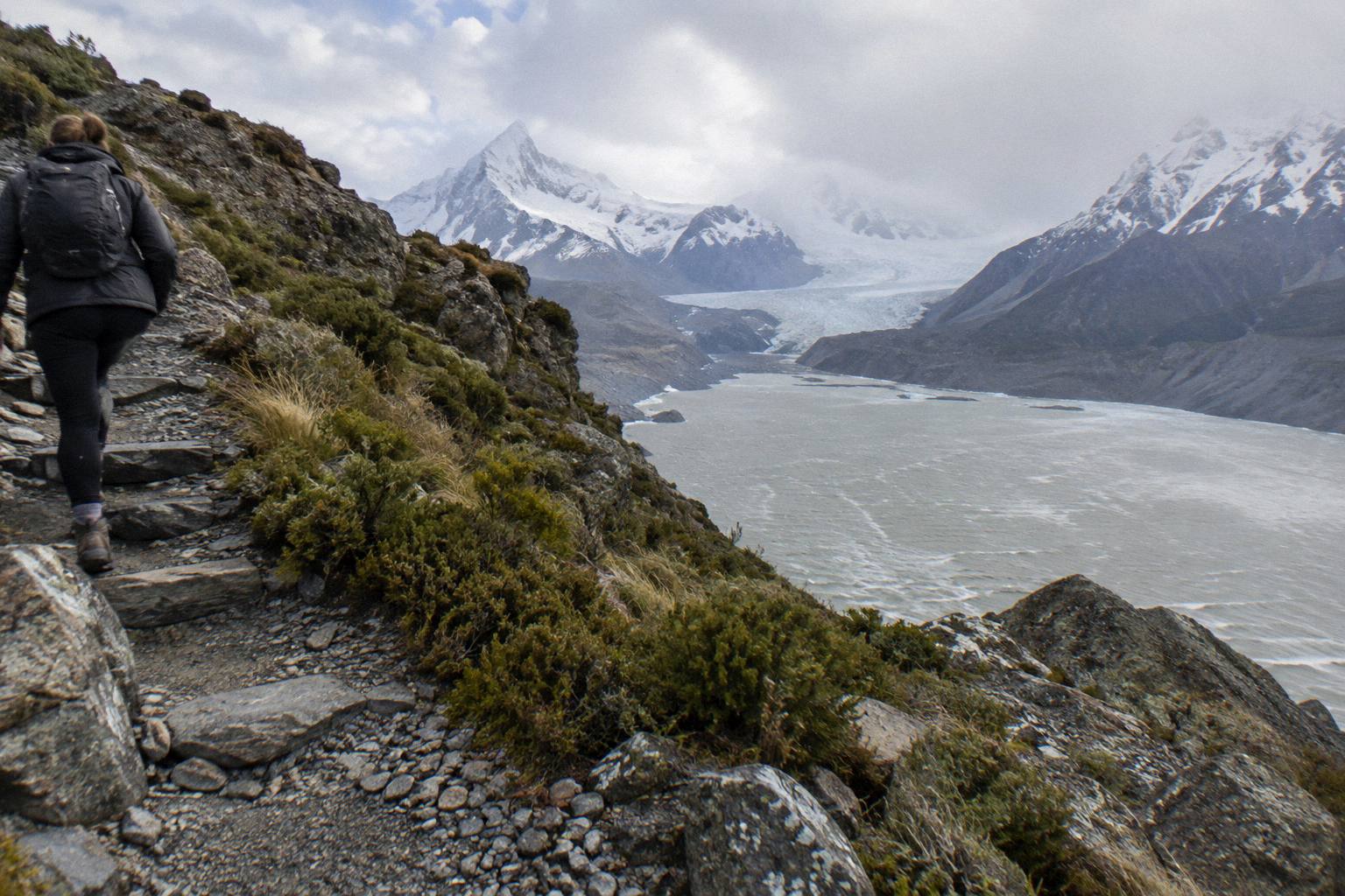
The Tasman Glacier View Track is a free 1.5 km return walk of about 30 minutes from the Tasman Valley car park, climbing 300 or more steps to a viewpoint on the moraine wall above the glacier and the lake, with the Blue Lakes a 5-minute side trip one way. The car park is free, roughly 10 minutes by road from the village, and DOC says the valley road is the second left after Hooker Valley Road.
For anyone adding a ground-level look at the glacier to a heli hike day, this is the walk. The viewpoint sits on the moraine wall, so you look down across the rock-covered lower glacier to the grey lake and, in summer, the icebergs drifting on it. The Blue Lakes signposted along the way were once blue and are now fed by rainwater and look green, a small illustration of how recently this whole landscape changed. With 300 or more steps it is not a stroll, but it is well within the ability of anyone considering the heli hike, whose operators ask for moderate fitness, the ability to walk at least a kilometre and to handle stairs comfortably, The Helicopter Line's stated benchmark.
If a 3-hour hike on the ice is beyond your budget or your knees, a snow-landing flight is the alternative, and it shows you more of the glacier's length than the hike does. The 40-Minute Tasman Landing from The Helicopter Line costs from NZ$713 per person, runs from Glentanner Park, includes a 5 to 10 minute alpine snow landing, and carries 60+ reviews on the booking page, with a 150 kg per-passenger weight rule for that operator. It is a flight with a landing, not a hike, but for seeing the full 23 kilometres in one sweep it is the stronger product.
| View track fact | Detail | Source |
|---|---|---|
| Distance | 1.5 km return | DOC |
| Time | About 30 minutes | DOC |
| Steps | 300 or more to the moraine-wall viewpoint | DOC |
| Blue Lakes side trip | 5 minutes one way, now green from rainwater | DOC |
| Car park | Free, Tasman Valley Road, about 10 minutes from the village | DOC |
| Seasonal sights | Icebergs in summer, lake ice in winter | DOC |
For hikers weighing the guided glacier walk against the free valley tracks, the comparison between the heli hike and the Hooker Valley Track covers the trade-offs in detail, and it answers whether the heli hike beats the free walks at Mount Cook.
What Surrounds The Glacier: Park Numbers Worth Knowing
Aoraki / Mount Cook National Park contains 19 peaks over 3,000 metres, led by Aoraki / Mount Cook itself at 3,724 m, New Zealand's tallest, with glaciers covering 40 percent of the park across five major valley systems, and the whole park lies within the Te Waipounamu South Westland World Heritage Area. The Tasman is the largest of those systems, but it is one arm of a much bigger ice field.
These numbers change how you read the flight. On the way up the Tasman valley the helicopter passes rock walls and hanging glaciers that belong to the Hochstetter and other tributaries, and on a clear day the pilot's commentary, included on the scenic flights, names peaks that would each be the centrepiece of a lesser national park. The DOC park page also carries the practical warnings that matter to planning: avalanches can occur in any season, snow can close SH80 and limit winter access from June to September, recreational drones are banned everywhere in the park, and White Horse Hill parking can fill between 10 am and 4 pm from November to March.
- 25-Minute Alpine LandingNZ$379
- 40-Minute Tasman LandingNZ$713
- 55-Minute Glacier FlightNZ$949
Small-flight options from Mount Cook Airport give the same views without the hike. The 25-Minute Alpine Landing run by Mount Cook Ski Planes and Helicopters costs from NZ$379 per person, carries 54 reviews on the booking page, and needs a minimum of 4 people before a flight operates. It includes headsets and live commentary, and like every product in this valley it depends on the weather.
Weather is the one force that outranks everything else here, and since every operator from the heli hike to the 25-minute flight cancels for it, the guide to heli hike weather and cancellations is the natural next read.
| Park fact | Figure | Source |
|---|---|---|
| Tallest peak | Aoraki / Mount Cook, 3,724 m | DOC |
| Peaks over 3,000 m | 19 | DOC |
| Glacier cover | 40 percent of the park | DOC |
| Major glacier valley systems | Godley, Murchison, Tasman, Hooker, Mueller | DOC |
| Status | Part of Te Waipounamu South Westland World Heritage Area | DOC |
Armed with the facts above, the booking choice comes down to budget and appetite: the full heli hike onto the ice, the parallel brand with its own age and weight rules, or a shorter flight that shows the whole glacier from above.
Common Questions About Tasman Glacier Facts
How Long Is The Tasman Glacier?
The Tasman Glacier is 23 km long, up to three km wide and covers 101 square km, making it New Zealand's largest and longest glacier according to the Department of Conservation.
Why Does The Tasman Glacier Look Grey From The Road?
Its lower reaches are covered in rock, moraine swept from the valley walls, which forms a grey mantle over the ice. The clean white ice a heli hike lands on sits well above, around 1,200 m above sea level per Alpine Guides.
When Did Tasman Lake Form?
Tasman Lake did not exist until 1974, DOC states, and it has been growing rapidly as the glacier melts ever since. Summer brings icebergs to the lake; winter brings lake ice.
Is The Tasman Glacier Retreating?
Yes. DOC says plainly that, like glaciers worldwide, the Tasman is retreating as the climate changes, and a 2026 snowline survey called recent retained snow "only a stay of execution" against the long-term decline in ice coverage.
Can I See The Tasman Glacier Without A Helicopter?
Yes. The free Tasman Glacier View Track runs 1.5 km return, about 30 minutes with 300 or more steps, to a moraine-wall viewpoint above the glacier and lake from the free Tasman Valley car park, 10 minutes from the village.
How Many Companies Run The Glacier Heli Hike?
Three brands sell a very similar heli hike: Mt Cook Glacier Guiding flying with Mount Cook Ski Planes and Helicopters, The Helicopter Line with Alpine Guides, and Southern Alps Guiding. Their minimum ages, stated durations and terms differ, so check the specific brand before booking.